Eastern Greater Yellowstone Mule Deer Project
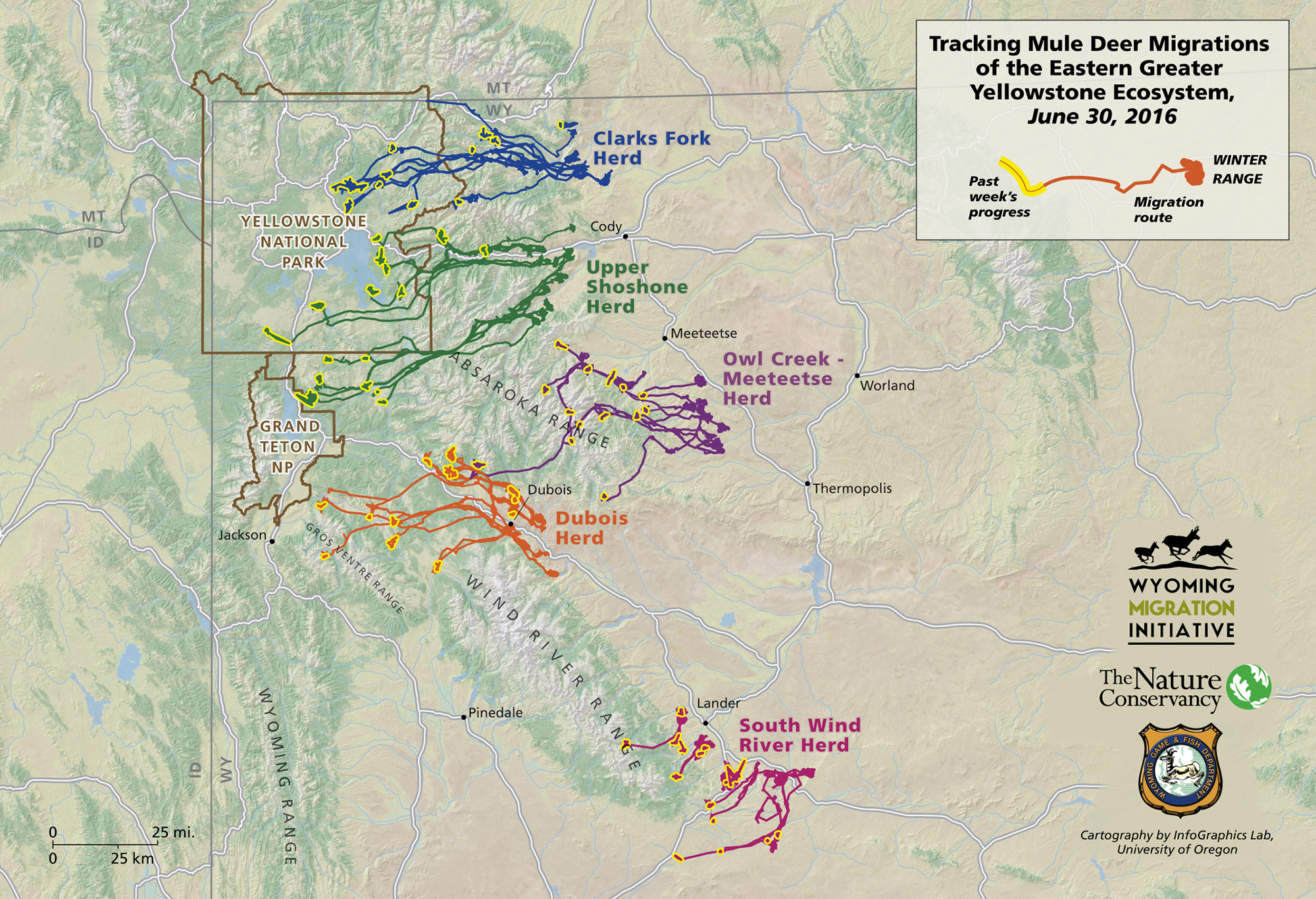
This interactive map shows the movement of mule deer along routes used during the spring migration from winter ranges up into the mountains. Use the time slider to control the animation and the zoom to see specific areas more closely.

Project Overview
In March 2016 the Wyoming Migration Initiative and its partners launched a landmark study to map mule deer migration corridors over the entire eastern portion of the Greater Yellowstone Ecosystem. It is a large collaring effort focused on five herds and spanning an area from the Wind River valley to the Bighorn Basin.
The study is a unique collaboration between the Wyoming Migration Initiative, the Wyoming Game and Fish Department, and The Nature Conservancy.
Data from the 2016 spring migration was embedded in this interactive map created with our partners at the University of Oregon InfoGraphics Lab.
The project documents in detail the migration corridors of several key herds that have never been the focus of the latest tracking technology. Specifically, the study targets deer in five separate herds near Cody, Meeteetse, Dubois, and Lander.
All 90 animals captured in 2016 were fitted with “real-time” GPS collars that send data back to researchers every three days. A second collaring effort to reach needed sample sizes on these same herds will occur in 2017. Individual mule deer will carry the collars for up to two years, gathering data from two cycles of spring and fall migration.
Once the migration data is collected, researchers assess the migration corridors by looking for threats and conservation opportunities across the landscapes they occupy. The identification of potential fencing issues, road crossing concerns, or key habitats at risk of residential development can help target conservation efforts on the ground. The assessment of the EGYE migration corridors will follow the successful approach the WMI team developed for the Red Desert to Hoback migration assessment.
The real-time data from these collars allows researchers to share what they learn with the public as deer migrate through one of the wildest areas of the continental United States. From late March through mid-summer 2016 the collaborators posted maps of these migrations on Facebook and Twitter using the hashtag #wyodeer.
project funders
The study is made possible in part by the Knobloch Family Foundation, The Wyoming Nature Conservancy, the Bole and Klingenstein Foundation, Wyoming BLM, Wyoming Governor’s Big Game License Coalition, 10 Country Chapter of Muley Fanatic Foundation, and the EA Ranch of Dubois.
