Migration Mapper 3.1
MIGRATION MAPPER 3.1 IS NOW AVAILABLE!!! Click on the “Migration Mapper User Guide” to learn more!
Project Overview
Migration Mapper™ is a free application designed for researchers, biologists, and managers, to analyze fine-scale GPS collar data collected from migratory ungulates.
Understanding and mapping where animals go is of utmost importance to wildlife conservation and management. Maps of animal movement are particularly important for efforts focused on migratory wildlife, as migratory animals rely on connected, seasonal habitats that span large landscapes.
In 2009, WMI researchers devised a method for analyzing GPS collar data collected from migratory ungulates (Sawyer et al. 2009). This methodology allows for identifying, mapping and prioritizing migration corridors. The methodology involves 1) a Brownian bridge movement analysis of GPS collar data collected for individual animals and 2) a prioritization analysis based on the number of animals migrating through specific areas. The issue with this methodology, however, is that it is computationally intensive, and requires coding and analysis skills that are beyond the reach of most biologists and managers. Therefore, WMI has invested in development of this application, which facilitates the technologically challenging analyses of animal movement and migration data.
HOW IT WORKS
Migration Mapper™ was not developed to be a ‘pull-the-handle-and-see’ program. Instead, Migration Mapper provides a number of interfaces to help users analyze their data. Users must provide Migration Mapper information to identify movement corridors and seasonal ranges. Thus, you should expect to spend some time working with your data before Migration Mapper spits out a map of movement corridors or seasonal ranges. The user starts with a cleaned GPS collar dataset in ESRI Shapefile format.
MAPP is modular and consists of six standalone applications representing distinct steps of the workflow. Each of the applications are accessed through the main MAPP homepage. Modularity clarifies the step-by step process and allows users to easily navigate between steps, fix errors or make changes in a previous step, or even skip certain steps in the workflow. The modules include: 1) data cleaning and review, 2-3) seasonal movement delineation, 4) movement model application, 5) calculating population-level outputs, and 6) visualizing the outputs.
MIGRATION MAPPER PROVIDES THE USER WITH A NUMBER OF OUTPUTS INCLUDING:
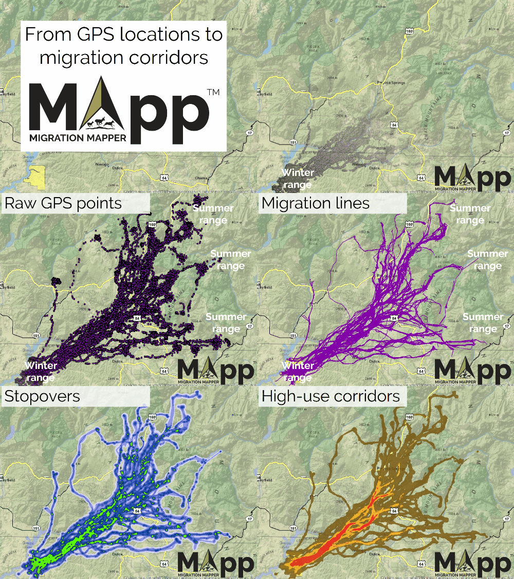
- shapefiles of identified movement sequences (as points and lines)
- shapefiles of movement corridors (including migration corridors) and seasonal ranges (including stopovers);
- a table of the start and end dates of identified movement seasons for every individual animal;
- raster layers of individual and population-level occurrence distributions of movement corridors and seasonal ranges; and
- shapefiles of the GPS locations used in the Brownian Bridge Movement Analysis.
MIGRATION MAPPER WEBINAR
In May 2019 Matthew Kauffman, Jerod Merkle, and Holly Copeland of the USGS Corridor Mapping Team based at the University of Wyoming – Wyoming Cooperative Fish and Wildlife Research Unit hosted a webinar to train wildlife managers in using the Migration Mapper software. The primary goal of the USGS Corridor Mapping Team is to provide technical assistance to states in mapping their corridors, as part of the implementation of Department of the Interior Secretarial Order 3362.
Project funders
Support for the development of Migration Mapper™ has come from Western Association of Fish and Wildlife Agencies, The Pew Charitable Trust, and The Knobloch Family Foundation. We especially thank Josh Gage (with Gage Cartographics LLC) and Jerod Merkle for writing the majority of code and leading the development of Migration Mapper.


project timeline
The initial development of Migration Mapper™ was completed in autumn of 2017. WMI personnel began conducting workshops across western states in autumn 2017 to facilitate use of Migration Mapper. Workshops continue in 2018. So far, these Regional Crucial Habitat Assessment Tool: Wildlife Movement and Migration Analysis Workshops have provided training to state wildlife managers from Arizona, California, Colorado, Nevada, New Mexico, Oregon, Texas, Utah, and Washington. The workshops are hosted by the Mule Deer Working Group of the Western Association of Fish and Wildlife Agencies (WAFWA), the Sagebrush Science Initiative (a joint effort of the U.S. Fish and Wildlife Service and WAFWA), the U.S. Geological Survey, the Wyoming Migration Initiative, the Mule Deer Foundation, and The Pew Charitable Trusts.
Downloads & Links
LICENSE INFORMATION
View the non-commercial software license agreement and terms
